
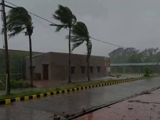
New Delhi, October 25, 2026: Andhra Pradesh and Odisha are preparing for severe weather as a depression over the Bay of Bengal is expected to strengthen into a powerful cyclonic storm over the next few days. The India Meteorological Department (IMD) has warned of heavy rainfall along the eastern coast, with the system likely to approach Andhra Pradesh around October 28.
According to the latest forecast, the depression could intensify into a cyclonic storm by the morning of October 26 and become a severe cyclonic storm by October 27. It may further strengthen into a very severe cyclonic storm by October 28 as it moves towards the coast. These are forecast stages, and the system’s actual strength and movement will depend on how it develops.
The developing weather system has prompted authorities to issue warnings and review preparations in coastal areas. The Andhra Pradesh State Disaster Management Authority (APSDMA) has urged people to remain alert and follow official updates as the situation changes.
Depression Over Bay of Bengal Continues to Develop
The IMD’s forecast indicates that the system formed over the east-central and adjoining south-east Bay of Bengal. At 5.30 am on October 25, it was moving south-eastwards at around 5 kmph.
At that time, the depression was approximately 880 kilometres east-southeast of Visakhapatnam and 980 kilometres east-southeast of Kakinada. It was also around 1,080 kilometres east-southeast of Machilipatnam and 1,150 kilometres east of Bapatla, according to the APSDMA update.
The system is expected to move nearly southwards before changing direction towards the west-northwest. The weather department expects it to strengthen further as it travels across the Bay of Bengal.
If the forecast remains on track, the system could reach the west-central Bay of Bengal near the Andhra Pradesh coast by the morning of October 28. The IMD is continuing to monitor its movement and intensity, and further bulletins may revise the forecast as fresh observations become available.
Possible Landfall Along Andhra Pradesh Coast
The current forecast suggests that the storm could cross the Andhra Pradesh and Yanam coasts between Bapatla and Visakhapatnam by the forenoon of October 28.
The predicted wind speed at the time of crossing is 115–125 kmph, with gusts potentially reaching 140 kmph. If these conditions occur, coastal areas could face strong winds and heavy rainfall.
The APSDMA has advised residents to take the warnings seriously and remain attentive to instructions from local authorities. People living in areas vulnerable to flooding or strong winds should follow any evacuation or safety directions issued by officials.
The exact impact will depend on the system’s final track, strength and distance from populated areas. A projected landfall should therefore be treated as a forecast rather than a confirmed event.
Heavy Rain Expected in Andhra Pradesh and Odisha
Rainfall is another major concern as the system approaches the coast. The IMD has forecast heavy to extremely heavy rain in parts of coastal Andhra Pradesh and Odisha between October 27 and 29.
Some locations may receive very high rainfall within a short period, increasing the possibility of waterlogging and local flooding. Strong winds and rough sea conditions may also affect coastal communities and maritime activities.
Odisha could experience heavy rain even if the storm’s projected crossing remains along the Andhra Pradesh coast. Weather systems over the Bay of Bengal can influence rainfall across neighbouring coastal states, depending on their movement and circulation.
The IMD has also warned that the system could affect other parts of eastern and central India through rainfall. However, the intensity and distribution of rain may vary by district, making regular weather updates important for residents and local administrations.
Authorities Urge People to Stay Alert
Disaster management agencies are monitoring the developing situation as the forecast points to a possible strong storm near the coast. Residents should keep track of official advisories, avoid unnecessary travel in areas facing severe weather and stay away from the sea when warnings are in force.
Fishermen should follow the IMD’s sea-condition advisories and avoid entering the affected waters during the warned period. People in low-lying coastal locations should also remain prepared to act on instructions from district authorities.
The name assigned to the next cyclone in the regional naming list is Arnab, a name contributed by Bangladesh. The system will be called by that name if it reaches the required classification as a cyclonic storm.
For now, the main concern is the depression’s expected strengthening over the Bay of Bengal and its possible approach towards the Andhra Pradesh coast. The coming days will be important in determining its final intensity, path and impact on the eastern coastline. Authorities and residents have been advised to stay informed as the IMD issues further updates.
